


Monday, October 31, 2011
October storm's power outages top Hurricane Irene's numbers
0 comments Posted by Jeff adams at 2:28 AM
Last month, Hurricane Irene left more than 260,000 PPL customers without power.
The rare October nor’easter that on Saturday dumped 5.5 inches of heavy snow in the Harrisburg area was worse.
Saturday’s storm left 315,000 PPL customers in central and eastern Pennsylvania and 257,000 Met-Ed customers without electricity.
By 7:15 p.m. Sunday, PPL still had 150,000 customers without electricity in its 29-county region, including 1,995 in Cumberland County, 3,027 in Dauphin County, 1,003 in Lebanon County, 1,288 in Perry County and 1,998 in York County.
The outages occurred when leaf-laden trees bent and broke under the heavy snow and fell on power lines and poles. In a company statement, PPL called the Lehigh Valley the hardest-hit region, with 125,000 customers affected, followed by the Harrisburg and Lancaster areas.
“With a storm of this magnitude, it could take days until we can restore service to all customers,” said David DeCampli, PPL Electric Utilities president. “Our crews are assessing the damage by foot, by vehicle and by air. We’re focusing on repairs that can restore power to the largest numbers of customers as quickly and safely as possible.”
He said about 1,000 workers on 250 crews responded to outages. An additional 150 crews from western Pennsylvania, Ohio, Indiana, Michigan, North Carolina, West Virginia, Virginia, Kentucky and Tennessee joined the restoration effort.
It was a familiar job for electricity workers, who in September replaced miles of power lines and more than 1,200 utility poles, 300 transformers and thousands of pieces of pole-top equipment damaged by Hurricane Irene.
The storm also affected transportation through the midstate.
Greg Penny, Pennsylvania Department of Transportation District 8 spokesman, said that as of 6 p.m. Sunday, about 30 roads in the eight-county district remained closed because of downed trees on power lines. Most of these were in York County, he said.
“PennDOT crews remove trees and branches from the roads when power lines are not involved,” he said. “But if the trees or limbs are entangled with power lines, we have to wait for the utility crew to come in and safely clear the electric power line. Right now, utility crews are busy restoring electricity.”
Penny also said Route 11 at the West Pennsboro and Penn townships border near Newville remains closed in both directions. He said state police requested the closure because they are concerned that a silo that appears to be leaning might fall on nearby power lines and the road.
Read more
Thursday, October 20, 2011

Utility representatives and state emergency officials testified Tuesday at a joint hearing of two Senate committees about lessons learned from Hurricane Irene and Tropical Storm Lee.
The hearing was prompted by constituent complaints to senators about a lack of communication from the utilities and the lag in restoring service in some areas.
About 706,000 Pennsylvanians had no electricity during the peak of the outages caused when Irene barreled through the state on Aug. 28. Some residents went without power for 10 days.
Just over a week later, the state was hit with historic flooding from the remnants of Tropical Storm Lee.
Utility officials stressed how destructive the storms were to transmission lines and distribution systems. But Sen. Lisa Baker, R-Luzerne, said the lack of communication with customers left residents "powerless and in the dark," literally and figuratively.
Many irate residents had no idea when their service would be restored in the days after Irene, Baker said. Some saw utility trucks parked in their neighborhoods for hours only to watch them leave — without having restored the power, she said.
Carl Segneri, an executive with Allentown-based utility PPL Corp., said the volume of calls to report damage during Irene exceeded the company's phone system capacity. The problem was compounded by breakdowns in the outage management system, he said.
PPL is evaluating its technology to see how it can improve reliability and performance, Segneri said.
UGI Utilities Inc. plans to acquire better weather forecasting tools and buy a new system to manage power outages, executive Robert Stoyko told lawmakers.
Read more
Friday, October 14, 2011

The United Nations said as many as 100,000 people had been affected in Mexico and Central America, while the U.S. National Hurricane Center (NHC) warned that more heavy rains would pound the region in the next 48 to 72 hours.
"Locally heavy rains are likely to continue over portions of the Pacific coast of southeastern Mexico and Central America, resulting in life-threatening flash floods and mudslides," said the NHC in its latest forecast for one of two storms currently moving over southern Mexico and Central America.
Civil protection authorities across Mexico, Guatemala, Honduras, El Salvador, Nicaragua and Costa Rica continued to be on maximum alert.
A second storm was forming over the eastern part of Mexico and Central America, and although neither of the two storms seem likely to become hurricanes, the NHC warned that the second storm will cause heavy rains,mudslides and flooding in Central America, Cuba and nearby islands.
Nicaraguan President Daniel Ortega raised the alert for the country and broke off an election campaign to attend to what he declared a "national emergency" as the death toll in Nicaragua climbed to seven due to the rains.
Salvadorian President Mauricio Funes declared a state of national emergency over the massive flooding in coastal areas and initiated plans to evacuate 65,000 people from areas vulnerable to more flooding and landslides in the next three days.
The United Nations said it had activated its emergency and assessment teams in Nicaragua and El Salvador.
"Some 100,000 people in Mexico and Central America are facing flooding as Hurricane Jova and a tropical depression unleash torrential rains over the region," the United Nations news center said.
At least 12,000 people have been evacuated in the five countries worst hit by week-long torrential rains caused by Hurricane Jova, Hurricane Irwin, tropical depression 12-E and two other independent storm systems.
Diamond Studs
Read more
Thursday, October 13, 2011
At Least Five Killed as Hurricane Jova Slams Mexico's Pacific Coast
0 comments Posted by Jeff adams at 6:48 AM
MANZANILLO, Mexico – Hurricane Jova slammed into Mexico's Pacific coast as a Category 2 storm early Wednesday, killing at least five people and injuring six, while a tropical depression hit farther south and unleashed steady rains that contributed to 13 deaths across the border in Guatemala.
Jova came ashore west of the Mexican port of Manzanillo and the beach town of Barra de Navidad before dawn with 100 mph winds and heavy rains, before moving inland and weakening to a tropical depression by afternoon. It continued to dump rain over a large swath of northwest Mexico, including Jalisco state where rainfall this year had been low.
A 71-year-old woman drowned in Colima state after a strong current swept away the car in which she and her son were riding. Her son survived, Colima Gov. Mario Anguiano said.
In the neighboring state of Jalisco, Jova triggered a mudslide in the town of Cihuatlan, just inland from Barra de Navidad, that swept away a house on a hillside, killing a 21-year-old woman and her daughter, Jalisco civil protection officials said in a statement.
Farther northwest along the Mexican coast in the town of Tomatlan, about 12 miles from where Jova landed, a man and a teenage boy were killed when a wall of their home softened by heavy rains fell on them, officials said.
Also in Tomatlan, two children suffered head injuries when the walls of their brick home collapsed under the force of the wind and rains, said Oscar Mejia, spokesman for the Jalisco state Red Cross rescue division.
The new tropical depression formed in the Pacific off far-southern Mexico near the Guatemala border, with maximum sustained winds near 35 mph, the U.S. National Hurricane Center reported. The storm quickly moved ashore over Mexico and was expected to move slightly north before dissipating before day's end.
The storm was smaller and less powerful than Jova, but the mountainous terrain of southern Mexico state of Chiapas and neighboring Guatemala is particularly vulnerable to flash flooding and mudslides. Numerous Indian villages perch precariously on hillsides.
Guatemalan President Alvaro Colom blamed rain from the storm for the deaths of 13 people in his country. At least four of those were electrocuted when contacted power lines, Colom said. Others died in mudslides or were swept away by swollen rivers.
National Hurricane Center forecaster John Cangialosi said the rains in Guatemala probably were linked to the tropical depression, even though it had not yet hit land.
"If they're in Guatemala, they're pretty close to the circulation center of the system, and it has been a very slow-moving system ... so it's likely linked to this feature," Cangialosi said.
Farther north on Mexico's coast, flooding from Jova was so bad in Cihuatlan that the Red Cross office had to be evacuated because it was filled with 4 feet of water.
Mexico's navy said it evacuated a total of 2,600 people in flood-prone areas hit by Jova, and set up kitchens at shelters to feed 1,600 evacuees.
The approach of Jova led authorities to close the port in Manzanillo, which is Mexico's second-biggest non-oil cargo port. The storm flooded some neighborhoods in the city and brought down power lines and billboards. Flooding knocked out at least one bridge and destroyed stretches of highways leading out of Manzanillo.
The federal Communications and Transportation Department said that several roads were damages by the storm and that landslides and flooding blocked three main highways connecting cities in Jalisco and Colima states.
Diamond studs
Read more
Wednesday, October 12, 2011

The storm toppled trees, knocked out power and flooded streets in the major port city of Manzanillo, but the full extent of damage was still unclear before dawn Wednesday. There were no immediate reports of deaths.
The U.S. National Hurricane Center said Jova's maximum sustained winds were near 100 mph (160 kph) when it hit, but it was weakening steadily as it moves inland and winds were down to 75 mph (140 kph) by 7 a.m (8 a.m. EDT; 1200GMT).
As the storm's leading rain bands began swatting at the coast Tuesday night, heavy rain fell in Manzanillo, Mexico's second-biggest non-oil cargo port. It was closed to navigation because of the storm.
Callers told local station Radio Turquesa that water was several feet (more than a meter) deep in some neighborhoods and schools, some used for shelters, were closed for the day.
The Hurricane Center in Miami warned that the storm surge could cause significant coastal flooding along the 210-mile (340-kilometer) stretch between Manzanillo and Cabo Corrientes, which is southwest of the resort city of Puerto Vallarta.
Up to 20 inches (50 centimeters) of rain could fall on isolated areas as Jova moves inland, the center said.
Before nightfall Tuesday, marines visited flood-prone areas in Manzanillo to advise people to leave. They found a home for elderly people whose homes were already flooded and evacuated dozens of people to stay with relatives, Adm. Jaime Mejia said. Forty others were evacuated in the nearby town of Tecoman, he said.
Some people vowed to ride out the storm, while others took refuge at shelters in towns like Jaluco, just inland from the beach community of Barra de Navidad.
"My house has a thatch roof, and it's not safe," said Maria de Jesus Palomera Delgado, 44, a farmworker's wife who went to an improvised shelter at a grade school in Jaluco, along with her 17 children and grandchildren.
"The neighbors told us the house was going to collapse" if hit by the hurricane, she added as the children slept nearby on folding cots packed into a classroom.
In an another classroom, migrant farmworker Rufina Francisco Ventura, 27, fed her 2-month-old son. She said she had left the ranch where she plants chiles and tomatoes planning only to pick up some free blankets, but shelter workers "told me I shouldn't leave here, because it's going to hit hard."
Jalisco state authorities evacuated about 200 people to shelters by Tuesday and issued alerts over loudspeakers placed in communities along the coast, telling people to take precautions as the hurricane approached, state civil defense spokesman Juan Pablo Vigueras said. The state had 69 shelters ready, he said.
Authorities also set up shelters for residents of inland towns, where the mountainous terrain could cause flash floods and mudslides, which often pose the greatest dangers in hurricanes
The Mexican army said it had assigned about 1,500 soldiers to hurricane preparedness and relief efforts.
Diamond studs
Read more
Tuesday, October 11, 2011

Mexican authorities have placed four southern coastal states on high alert ahead of the expected arrival of the category three storm.
The Miami-based US National Hurricane Center said in a 0900 GMT bulletin that Jova was packing maximum sustained winds of 185 kilometers (115 miles) per hour and was 235 kilometers (150 miles) southwest of the busy port city of Manzanillo, in Colima state. It was moving north-northeast at 9 km/h (6 mph).
"The center of the hurricane will be near the coast of Mexico in the hurricane warning area by this afternoon or evening," the NHC said, adding it expected the storm to reach the coast at "near major hurricane strength."
Mexico has issued hurricane alerts for large swaths of the Pacific coast.
The zone stretched north from the port of Lazaro Cardenas in Michoacan for almost 480 kilometers (298 miles), encompassing the popular tourist cape of Cabo Corrientes in Jalisco, Mexico's meteorological institute said.
Colima, Jalisco, Michoacan and Nayarit state to the north were all put on guard for possible landslides from heavy rain expected to be dumped by the ninth Pacific hurricane of the season.
"A dangerous storm surge is expected to produce significant coastal flooding near and to the east of where the center makes landfall," the NHC warned.
The surge, said the hurricane center, "will be accompanied by large and destructive waves" as well as torrential rainfall with accumulations of up to 20 inches (50 centimeters) in some areas.
"These rains could cause life-threatening flash floods and mud slides over mountainous terrain," the NHC said.
Several major storms or hurricanes have buffeted Mexico's Pacific coast in recent months but most have remained offshore.
The season's first named storm, Arlene, left at least 16 people dead and drenched much of the country in July.
Tropical storms and hurricanes last year caused flooding and mudslides in Mexico that killed 125 people, left hundreds of thousands homeless and caused more than $4 billion in damage.
Diamond Earring Studs
Read more
Friday, September 30, 2011

Boys wade through the backyard of Donna and Kevin Tyndall after Hurricane Irene flooded their home in Vandemere in Pamlico County in August.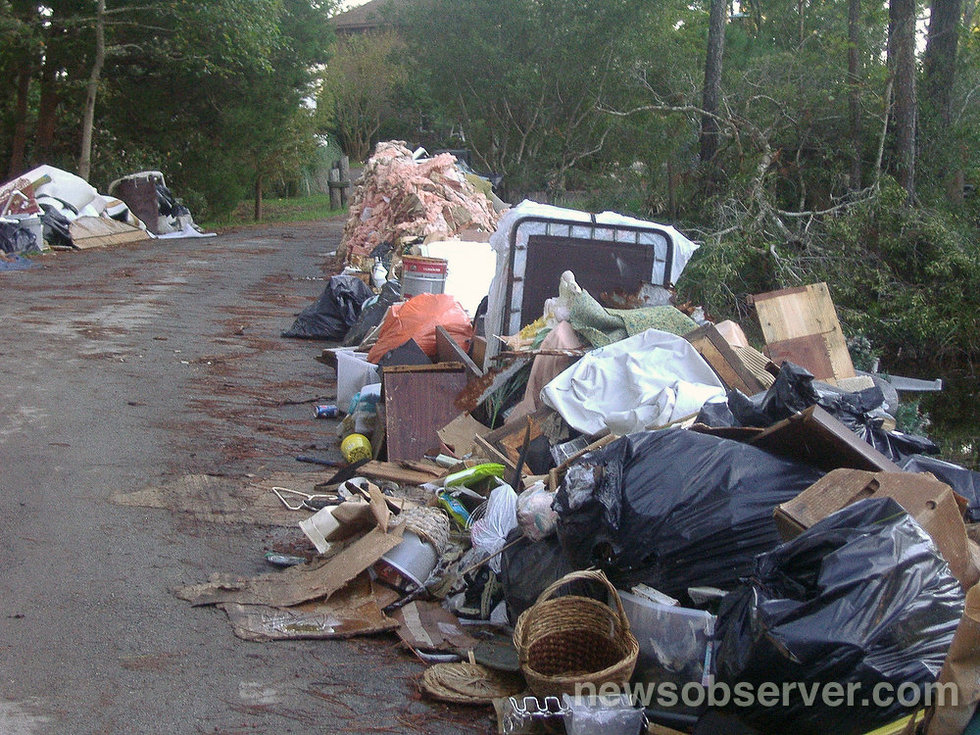
Many of the roads in Vandemere are still cluttered with debris.
Monday, September 26, 2011
Hurricane Aircraft -- Technological Marvels That Fly Through Storms
0 comments Posted by Jeff adams at 10:40 PM
Read more
Sunday, September 25, 2011
Hurricane Hilary 2011: Storm Could Bring Southwest, Texas Needed Rainfall
0 comments Posted by Jeff adams at 10:52 PM
Forecasters say Hurricane Hilary, currently off the western coast of Mexico, will pose a threat to shipping and cruise interests, while creating rough surf along the southwest Mexican coast as the storm turns to the north. Models show Hilary will be north and west of its current location by Wednesday night, and winds will likely have subsided to Category 1 strength.
But after that, the U.S. southwest and maybe even Texas could benefit from the storm if it re-curves as some models show, into northern Baja California.
Read more
Monday, September 19, 2011
NASA's TRMM Satellite Sees Moderate Rainfall Tropical Storm Sonca
0 comments Posted by Jeff adams at 1:43 AM
TRMM passed over Tropical Storm Sonca and its precipitation radar instrument saw moderate rainfall occurring mostly on the southern side of the storm, while light-to-moderate rainfall was occurring throughout the storm. The southern edge of the storm had rainfall rates between .78 to 1.57 inches (20 to 40 mm) per hour. The TRMM satellite is managed jointly by NASA and the Japanese Space Agency.
At 11 a.m. EDT on Sept. 16, Tropical Storm Sonca had maximum sustained winds near 45 knots (52 mph). It was centered about 500 nautical miles east of Iwo To, Japan, near 23.5 North and 149.4 East. Sonca was moving to the west at 15 knots.
Read more
Thursday, September 15, 2011

Belco reported a handful of power outages and police were not aware of any reports of damage.
Flights and ferry services were the worst hit - with all ferries except the Pink route cancelled and all flights at LF Wade International Airport also cancelled.
Several flights to and from the Island were cancelled yesterday as Bermuda braced itself for Tropical Storm Maria.
The storm, the third in as many weeks to affect the Island, passed at about 100 nautical miles to the west-northwest of the Island at its closest point at 1pm today.
Meteorologists predicted the Island would experience showers and possibly thunder, with south-easterly gusts from gale force to hurricane force this morning.
Conditions are expected to lighten as the day progresses and the storm moves further from Bermuda.
The Causeway remained open all day although it was monitored closely.
No large storm surge is expected, but rip currents and significant wave action were predicted, mirroring the effects of recent Tropical Storms Jose and Katia.
This afternoon a Government spokeswoman said: "While Bermuda has been spared any major impact from Tropical Storm Maria, the Island continues to feel remnants of the weather system.
"Winds at the Causeway saw a brief increase to 40 knots with gusts to 50 knots , but there have been no sustained winds reaching 50 knots today. However, Bermuda can expect a continuation of the tropical storm force winds for the next few hours.
Read full Article
Friday, May 20, 2011

A heavy rain with scattered thunderstorms is streamlining off of the Atlantic Ocean and gradually moves towards northward into northern New Jersey. Isolated thunderstorms are also expected Friday and Saturday yet Sunday promises to be sunny with only a 10 percent chance of rain and a high of almost 80 degrees. A chance remains over the next few days for some locally heavy downpours to initiate some flash flooding of roadways and streams.
The threat of showers and thunderstorms, especially in the afternoons, will remain and high temps will reach near and exceed 70º. A few breaks of sunshine will become more possible as well especially on Friday. Saturday will definitely see a return to at least partial sunshine, however, there is still probably going to be afternoon scattered showers/T-storms developing with highs in the mid-upper 70s. Hopefully by Sunday we can eliminate the threat of afternoon showers/storms. I'm calling for mostly sunny skies with highs in the mid-upper 70s at this moment.


